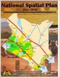
| dc.description.abstract | This National Spatial Plan is the first of its kind in the history of Kenya. The Plan is a strategic vision that defines the general trend and direction of spatial development for the country, covering the entire forty seven counties and the Exclusive Economic Zone (EEZ). It is a long term Plan spanning a period of thirty (30) years with 10 year periodical reviews. The preparation of the National Spatial Plan is recommended under Kenya Vision 2030 as a flagship project. under the Infrastructure Services section it has been identified as one of the foundations for socio-economic transformation.
The purpose of the National Spatial Plan is to provide a national spatial structure that defines how the national space is utilized to ensure optimal and sustainable use of land. This is imperative as it will facilitate the achievement of the land policy principles of efficiency, equity, sustainability and productivity. The Plan is anticipated to promote the attainment of national, social, economic and environmental goals and objectives. Further, the Plan provides strategies and policies to deal with national challenges including urbanization, regional imbalances/inequalities, rural development, environmental degradation, transportation and underutilization of the massive resources available in the country. | en_US |


