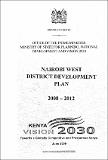
Nairobi District Development Plan 2008-2012
View/
Publication Date
2009Author
Type
Development Planviews
downloads
Metadata
Show full item recordBy
Ministry of State for Planning National Development and Vision 2030
Abstract/
Nairobi West District is one of the districts that form Nairobi Province. It covers an area of 359.7 Km2 and is situated between longitude 36° 40' east and 1° 25' South. The district borders Kiambu District to the North, Nairobi North to the East, Kajiado District to the South and Nairobi East to the Southwest. Administratively, the district is divided into three and further into 19 locations and 43 sub-locations. Kibera division occupies the largest area in the district, 223.4 Km2 while Dagoretti Division is the smallest with an area of 38.7 Km 2. The district is an urban district with no rural set up therefore the settlement structure is urban. It has high income estates such as Karen, Westlands, Kileleshwa, Lavington and Runda. These high income residential estates are characterized by low population density. There are also informal settlements, where many residents with low income reside, such as Kibera, Kawangware and Kangemi. These informal settlements have high population densities.The State House, several foreign embassies and the United Nations headquarters at Gigiri (the only UN headquarters in the third world countries) are found in low density areas. Most of these are within Westlands Division. Westlands Division, though having some residential areas, is increasingly becoming a major commercial area. Dagoretti Division is predominantly an agricultural area where land is divided into shambas (farms) with numerous small ownerships while some people have more than ten acres in the area. Here residents practice urban/ peri-urban agriculture. The district headquarters is also located here. Kawangware also hosts some informal settlements where basic infrastructure is inadequate. In Kibera Division there are 420,671 persons as of 2008 projections. Out of this population, over 265,000 (63%) live in the informal settlements and provide labour to the industrial area of the adjacent Nairobi East District while others are engaged in self employment.
Subject/
Economic Development; Economic Planning; Natural Resources; Population Distribution
Affiliated Ministerial Docket
Ministry of National Treasury and PlanningPublisher
Government printersSeries
Development Plan 2008-2012Collections
Related items
Showing items related by title, author, creator and subject.
-
Kakamega County Annual Development Plan Financial Year 2020-2021 Draft
County Government of Kakamega (County Government of Kakamega, 2020)This County Annual Development Plan is the first phase in the preparation of the County budget estimates for the FY 2020/21 and is the foundation for the Budget as provided for in the Public Finance Management Act, 2012. ... -
Vihiga County Annual Development Plan 2019/2020
County Government of Vihiga (County Government of Vihiga, 2019)This ADP reviews the county sector performances in the previous plan period and outlines programmes and projects the County Government seeks to implement in the financial year 2019/2020. A review of implementation of the ... -
Nakuru City County Annual Development Plan 2016/2017
County Government of Nakuru (County Government of Nakuru, 2015)The 2016/17 County Annual Development Plan is the second to be prepared by the Nakuru County Government. It sets out the County’s priority programmes to be implemented in the Financial Year 2016/2017 under the Medium Term ...


