
Search
Now showing items 1-6 of 6
Turkana North District Development Plan 2008-2012
(Government printers, 2009)
Turkana North District is situated in the northern half of the Rift Valley Province. It is one of the 43 districts of the Rift Valley Province. The district is administratively divided into seven divisions, 26 locations ...
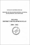
Tigania District Development Plan 2008-2012
(Government printers, 2009)
Tigania District is one of the districts in Eastern Province of Kenya. The district has a total area of 1,125 Km2• It borders lgembe District to the North, Imenti North to the South, Tharaka District to the East and Isiolo ...
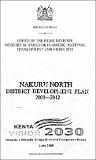
Nakuru North District Development Plan 2008-2012
(Government printers, 2009)
The 8th District Development Plan (DDP) for the period 2008-2012 was prepared by the District Planning and Monitoring Unit in close collaboration with members of the various Sector Working Groups (SWGs). Considerable effort ...
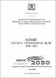
Igembe District Development Plan 2008-2012
(Government printers, 2009)
The district is in Eastern Province and ties within Latitudes 0° 00' and 0° 40' North, and Longitudes 37° 50' East, with the southern boundary lying along the equator. It covers an area of 1939 and borders Tigania East to ...
Laikipia West District Development Plan 2008-2012
(Government printers, 2009)
The 8th District Development plan (DDI,) for the period 2008-2012 was prepared by the district Planning and Monitoring Unit in close collaboration with members of the various Sector Working Groups (SWGs). Considerable ...
Loitokitok District Development Plan 2008-2012
(Government printers, 2009)
The 8th District Development Plan (DDP) for the period 2008-2012 was prepared by the District Planning and Monitoring Unit in close collaboration with members of the various Sector Working Groups (SWGs). Considerable effort ...