
Search
Now showing items 51-60 of 309
Teso District Development Plan 2002-2008
(Government printers, 2002)
The Teso District Development Plan (DDP) for the period 2002-2008 was prepared by the District Departmental Heads of various Ministries under the coordination of the District Commissioner (DC) assisted by the District ...
Kericho District Development Plan 1979-1983
(Government Printers, 1979)
Agriculturally, the District can be classified into three ecological zones, mainly based on the soil types, rainfall anu the attitude Out of the District's total land area of about 489,800 hectares, the high potential zone ...
Nyeri County Annual Development Plan 2022/2023
(County Government of Nyeri, 2021)
This County Annual Development Plan (CADP) for the FY 2022/2023 has been prepared in
accordance with Article 220(2) of the Constitution of Kenya and section 126 of the Public
Finance Management Act, 2012. It contains ...
Sotik District Development Plan 2002-2008
(Government Printers, 2002)
The 8th District Development Plan (DDP) for the period 2008-2012 was prepared by the District Planning and Monitoring Unit in close collaboration with members of the various Sector Working Groups (SWGs). Considerable effort ...
Vihiga District Development Plan 2008-2012
(Government printers, 2009)
The 8th District Development Plan (DDP) for the period 2008-2012 was prepared by the District Planning and Monitoring Unit in close collaboration with members of the various Sector Working Groups (SWGs). Considerable effort ...
Turkana North District Development Plan 2008-2012
(Government printers, 2009)
Turkana North District is situated in the northern half of the Rift Valley Province. It is one of the 43 districts of the Rift Valley Province. The district is administratively divided into seven divisions, 26 locations ...
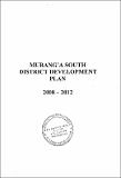
Murang'a South District Development Plan 2008-2012
(Government printers, 2008)
Murang'a South District (formerly Maragua) is one of the districts that make up the Central Province. It was carved from the larger Murang'a District (Now Murang'a North) in 1996. Murang'a South District borders Murang'a ...
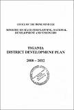
Tigania District Development Plan 2008-2012
(Government printers, 2009)
Tigania District is one of the districts in Eastern Province of Kenya. The district has a total area of 1,125 Km2• It borders lgembe District to the North, Imenti North to the South, Tharaka District to the East and Isiolo ...
Mbeere District Development Plan 2008-2012
(Government printers, 2009)
Mbeere district is one of the districts that form Eastern Province. The district borders Embu District to the North West. Tharaka district to the North, and Mwingi district to the East. Machakos district to the South and ...
Kirinyaga County Annual Development Plan 2021/2022
(County Government of Kirinyaga, 2021)
The 2021-22 Annual Development Plan has been prepared in accordance with Section 126 of the Public Finance Management Act 2012, and in accordance with Article 220(2) of the Constitution. It is also aligned to departmental ...